| Ruggell | |
|---|---|
 | |
| Basisdata | |
| Staat: | Fürschtetum Liechtestaan |
| Wahlkreis: | Unterland |
| Gmoandsummere: | 7010 |
| Poschtloatzahl: | 9491 |
| UN/LOCODE: | LI RGL |
| Koordinate: | 758322 / 234600 |
| Höhi: | 433 m ü. M. |
| Flächi: | 7.38 km² |
| Iiwohner: | 2354 (30. Juni 2020)[1] |
| Bevölkerigsdichti: | 319 Iiwohner pro km² |
| Uusländeraatoal: | 26,2 % (30. Juni 2017)[2] |
| Website: | www.ruggell.li |
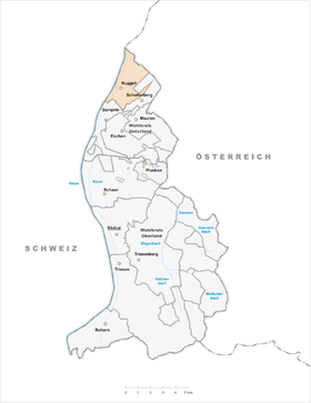
| Karte | |
 | |
| Dialäkt: Liechtestanisch |
Ruggäll (amtlich Ruggell) ischt a Gmond im Unterland vom Fürschtetum Liechtestaa.
- ↑ Bevölkerungsstatistik 30. Juni 2020. (PDF; 2,0 MB) In: llv.li. Amt für Statistik (AS), Fürstentum Liechtenstein, S. 14, abgruefen am 21. März 2021.
- ↑ Bevölkerungsstatistik. (PDF; 913 kB) 30. Juni 2017. Amt für Statistik (AS), Fürstentum Liechtenstein, S. 15, abgruefen am 31. Januar 2018.