| USGS-ANSS | ComCat |
|---|---|
| Local date | February 5, 1663 |
| Local time | 17:30 |
| Magnitude | 7.3–7.9 Mw |
| Epicenter | 47°36′N 70°06′W / 47.6°N 70.1°W |
| Areas affected | New France British America |
| Max. intensity | MMI X (Extreme)[1] |
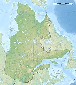
The 1663 Charlevoix earthquake occurred on February 5 in New France (now the Canadian province of Quebec), and was assessed to have a moment magnitude of between 7.3 and 7.9.[2] The earthquake occurred at 5:30 p.m. local time and was estimated to have a maximum perceived intensity of X (Extreme) on the Mercalli intensity scale. The main shock epicentre is suggested to have occurred along the Saint Lawrence River,[3] between the mouth of the Malbaie River on the north and the mouth of the Ouelle River on the south. A large portion of eastern North America felt the effects.[3] Landslides and underwater sediment slumps were a primary characteristic of the event with much of the destruction occurring near the epicentral region of the St. Lawrence estuary and also in the area of the Saguenay Graben.
The event occurred during the early European settlement of North America and some of the best recorded first hand accounts were from Catholic missionaries that were working in the area. These records were scrutinized to help determine the scale of damage and estimate the magnitude of the quake in the absence of abundant records from that time period.[4]
- ^ "M 7.0 – Near La Malbaie, Quebec, Canada". United States Geological Survey. Retrieved 17 May 2021.
- ^ Ebel 2011, p. 1024
- ^ a b Smith, W. E. (1962), Earthquakes of eastern Canada and Adjacent areas 1534–1927, vol. 26, Publications of the Dominion Observatory, pp. 271–301, archived from the original on 2013-01-01, retrieved 2008-10-10
- ^ Ebel 2011, p. 1025

