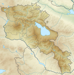
| Local date | June 4, 1679[1] |
|---|---|
| Magnitude | 6.4 Ms[2] |
| Epicenter | 40°12′N 44°42′E / 40.2°N 44.7°E[2] |
| Areas affected | Yerevan Province, Safavid Iran |
| Max. intensity | MMI IX (Violent)–MMI X (Extreme)[2] |
| Casualties | 7,600 dead[2] |
The 1679 Armenia earthquake (also called Yerevan earthquake or Garni earthquake) took place on June 4 in the Yerevan region of Armenia, then part of the Safavid Iran.[1]
Numerous buildings were destroyed as a result of the earthquake. In Yerevan most notable structures were damaged. The Yerevan Fortress was destroyed, so were the following churches: Poghos-Petros, Katoghike, Zoravor and the Gethsemane Chapel.[1]
Furthermore, the nearby Kanaker village was destroyed. The classical Hellenistic Temple of Garni also collapsed.[3] Among many churches and monasteries that were reduced to ruins were Havuts Tar, Saint Sargis Monastery of Ushi, Hovhannavank, Geghard, and Khor Virap.[3]
