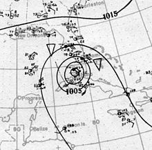
 Surface weather analysis of the hurricane over the Florida Keys on September 10 | |
| Meteorological history | |
|---|---|
| Formed | September 2, 1919 |
| Dissipated | September 16, 1919 |
| Category 4 major hurricane | |
| 1-minute sustained (SSHWS/NWS) | |
| Highest winds | 150 mph (240 km/h) |
| Lowest pressure | 927 mbar (hPa); 27.37 inHg |
| Overall effects | |
| Fatalities | 772 |
| Damage | $22 million (1919 USD)[nb 1] |
| Areas affected | Lesser Antilles, Puerto Rico, Hispaniola, Turks and Caicos, Bahamas, Cuba, Florida, Louisiana, Mississippi, Mexico, Texas, New Mexico |
| IBTrACS | |
Part of the 1919 Atlantic hurricane season | |
The 1919 Florida Keys hurricane (also known as the 1919 Key West hurricane)[1] was a massive and damaging tropical cyclone that swept across areas of the northern Caribbean Sea and the United States Gulf Coast in September 1919. Remaining an intense Atlantic hurricane throughout much of its existence, the storm's slow movement and sheer size prolonged and enlarged the scope of the hurricane's effects, making it one of the deadliest hurricanes in United States history. Impacts were largely concentrated around the Florida Keys and South Texas areas, though lesser but nonetheless significant effects were felt in Cuba and other areas of the United States Gulf Coast. The hurricane's peak strength in Dry Tortugas in the lower Florida Keys made it one of the most powerful Atlantic hurricanes to make landfall in the United States.
The hurricane developed near the Leeward Islands as a tropical depression on September 2 and gradually gained in strength as it tracked on a generally west-northwesterly path, crossing the Mona Passage and moving across the Bahamas. On September 7, the storm reached hurricane intensity over the eastern Bahamas. On September 9–10, the storm made its eponymous pass of the Florida Keys, passing over the Dry Tortugas with an intensity equivalent to that of a modern-day Category 4 hurricane. Over the next several days, the intense cyclone traversed the Gulf of Mexico, fluctuating in strength before making landfall near Texas' Baffin Bay on September 14 as a large Category 3 hurricane. As it tracked further inland, land interaction caused the storm to gradually weaken; the storm was last noted on September 16 over West Texas.
Cite error: There are <ref group=nb> tags on this page, but the references will not show without a {{reflist|group=nb}} template (see the help page).
- ^ Landsea, Christopher W.; Glenn, David A.; Bredemeyer, William; Chenoweth, Michael; Ellis, Ryan; Gamache, John; Hufstetler, Lyle; Mock, Cary; Perez, Ramon; Prieto, Ricardo; Sánchez-Sesma, Jorge; Thomas, Donna; Woolcock, Lenworth (May 2008). "A Reanalysis of the 1911–20 Atlantic Hurricane Database" (PDF). Journal of Climate. 21 (10): 2138–2168. Bibcode:2008JCli...21.2138L. CiteSeerX 10.1.1.269.2563. doi:10.1175/2007JCLI1119.1. S2CID 1785238. Retrieved January 18, 2015.