 The Sorlie Bridge connecting Grand Forks and East Grand Forks became submerged on April 17 | |
| Date | April 1997 |
|---|---|
| Location | |
| Deaths | 0 |
| Property damage | $3.5 billion[1] |
| Part of a series on the |
| Red River of the North |
|---|
 |
| Major Floods |
| Geology |
| Infrastructure |
| Related Topics |
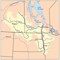
The Red River flood of 1997 was a major flood that occurred in April and May 1997 along the Red River of the North in Minnesota, North Dakota, and southern Manitoba. It was the most severe flood of the river since 1826. The flood reached throughout the Red River Valley, affecting the cities of Fargo and Winnipeg, but none so greatly as Grand Forks and East Grand Forks, where floodwaters reached more than 3 miles (4.8 km) inland. They inundated virtually everything in the twin communities. Total damages for the Red River region were US$3.5 billion. The flood was the result of abundant snowfall and extreme temperatures.
In Grand Forks, thousands of people, including Air Force personnel from Grand Forks Air Force Base, tried to prepare for the 1997 flood by building sandbag dikes. These dikes were constructed based on a 49-foot estimate of flooding set by the National Weather Service. The river crested at 54 feet in Grand Forks. Grand Forks mayor Pat Owens had to order the evacuation of more than 50,000 people, most of the population of the city, as a huge area was flooded. A large fire started in downtown Grand Forks, engulfing eleven buildings and sixty apartment units before being extinguished. Those affected by the flood in the U.S. received donations from across the nation, along with billions of dollars in federal aid. City officials and flood-forecasters were criticized for the difference in estimates and actual flood levels.
As a result of the 1997 flood and its extensive property losses, the United States and state governments made additional improvements to the flood protection system in North Dakota and Minnesota. A dike system was built on both sides of the river to protect the twin Forks cities. In the aftermath, the Federal Emergency Management Agency (FEMA) worked with the cities of Grand Forks and East Grand Forks to clear residential and business development from a large area of floodplain, because of the certainty of future regional floods, and also as the floodplain is intended to be a natural means to absorb floodwaters. They also redeveloped the floodplain along the river as the Greater Grand Forks Greenway, including several parks, a Minnesota state campground recreation area, and a 20-mile biking and walking trail.
Flooding in Manitoba resulted in over $500 million in damages. The Red River Floodway, an artificial waterway completed in 1968 and nicknamed "Duff's Ditch", exceeded its capacity flow but managed to divert the floodwaters around Winnipeg which minimized damage. From 2005 to 2010, the province made substantial upgrades to inlet control structures and fire protection, increased elevation of existing dikes (including the Brunkild dike), and widened the floodway channel.
- ^ Shelby, p. 149