| UTC time | 2006-10-15 17:07:49 |
|---|---|
| ISC event | 11122134 |
| USGS-ANSS | ComCat |
| Local date | October 15, 2006 |
| Local time | 07:07:49 Hawaii Standard Time |
| Magnitude | 6.7 Md[1] |
| Depth | 38.2 kilometers (24 mi)[1] |
| Epicenter | 19°52′37″N 155°56′06″W / 19.877°N 155.935°W[1] |
| Type | Oblique-normal[2] |
| Areas affected | Hawaii, United States |
| Max. intensity | MMI VIII (Severe) |
| Tsunami | Yes |
| Aftershocks | 6.1 Mw Oct 15 at 17:14 UTC[1] |
| Casualties | Several injured[2][3] |
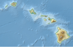
The 2006 Kīholo Bay earthquake occurred on October 15 at 07:07:49 local time with a magnitude of 6.7 and a maximum Mercalli intensity of VIII (Severe). The shock was centered 21 kilometers (13 mi) southwest of Puakō and 21 km (13 mi) north of Kailua-Kona, Hawaiʻi, just offshore of the Kona Airport, at a depth of 38.2 km (23.7 mi). It produced several aftershocks, including one that measured a magnitude of 6.1 seven minutes after the main shock. The Pacific Tsunami Warning Center measured a nondestructive tsunami of 4 in (100 mm) on the coast of the Big Island.[4]
- ^ a b c d "M 6.7 – Hawaii region, Hawaii". United States Geological Survey. Retrieved October 13, 2020.
- ^ a b Cite error: The named reference
PAGER-CATwas invoked but never defined (see the help page). - ^ Cite error: The named reference
CNN1was invoked but never defined (see the help page). - ^ "Strong Quake Rocks Hawaii". Local News. Maui Weekly. October 19, 2006. Archived from the original on September 28, 2007. Retrieved October 5, 2007.
