Parts of this article (those related to systems not using information from the Tropical Cyclone Reports) need to be updated. (July 2024) |
| 2023 Pacific hurricane season | |
|---|---|
 Season summary map | |
| Seasonal boundaries | |
| First system formed | June 27, 2023 |
| Last system dissipated | November 26, 2023 |
| Strongest storm | |
| Name | Otis |
| • Maximum winds | 165 mph (270 km/h) (1-minute sustained) |
| • Lowest pressure | 922 mbar (hPa; 27.23 inHg) |
| Seasonal statistics | |
| Total depressions | 20 |
| Total storms | 17 |
| Hurricanes | 10 |
| Major hurricanes (Cat. 3+) | 8 |
| Total fatalities | ≥ 67 total |
| Total damage | ≥ $13.071 billion (2023 USD) |
| Related articles | |
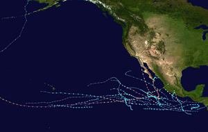
The 2023 Pacific hurricane season was an active and destructive Pacific hurricane season. In the Eastern Pacific basin (east of 140°W), 17 named storms formed; 10 of those became hurricanes, of which 8 strengthened into major hurricanes – double the seasonal average.[nb 1][2] In the Central Pacific basin (between 140°W and the International Date Line), no tropical cyclones formed for the fourth consecutive season, though four entered into the basin from the east.[3][4] Collectively, the season had an above-normal accumulated cyclone energy (ACE) value of approximately 168 units. This season saw the return of El Niño and its associated warmer sea surface temperatures in the basin, which fueled the rapid intensification of several powerful storms. It officially began on May 15, 2023 in the Eastern Pacific, and on June 1 in the Central; both ended on November 30. These dates, adopted by convention, historically describe the period in each year when most tropical cyclogenesis occurs in these regions of the Pacific.[5]
Forecasts at the outset of the 2023 season predicted busier-than-normal tropical cyclone activity in the eastern Pacific basin, largely due to El Niño.[6] However, no tropical cyclones developed until June 27, when Hurricane Adrian initially formed, becoming the latest first-named Eastern Pacific tropical storm since Tropical Storm Agatha in 2016.[7] In July, Hurricane Calvin became the season's first major hurricane, later passing just south of the Big Island of Hawaii as a tropical storm, bringing widespread rainfall to the area and neighboring Maui. In August, Category 4 Hurricane Dora passed south of the Hawaiian Islands and contributed to strong gradient winds over Hawaii, which in turn helped fan the flames of multiple devastating wildfires. [3] Later that month, Hurricane Hilary made landfall as a tropical storm in Baja California, later bringing torrential rainfall and gusty winds to the Southwestern United States. In early September, Hurricane Jova, the first Category 5 hurricane in the basin since 2018, caused rainfall, high waves and rip currents in areas previously affected by Hilary.
October saw four tropical cyclones strike the Pacific Coast of Mexico. Tropical Storm Max struck Guerrero on October 9, resulting in intense flooding. Less than two days later, Hurricane Lidia rapidly intensified into a Category 4 hurricane and made landfall at peak intensity on Jalisco.[8] Lidia was followed by Hurricane Norma, which made two landfalls in northwestern Mexico less than two weeks later. Hurricane Otis developed in the time period between Norma's landfalls, rapidly intensified into the second Category 5 hurricane of the season, and devastated Acapulco when it became the first Pacific hurricane to make landfall at Category 5 intensity, therefore surpassing Hurricane Patricia as the strongest landfalling Pacific hurricane on record.[9]
- ^ "Saffir-Simpson Hurricane Wind Scale". Miami, Florida: National Hurricane Center. Retrieved November 29, 2023.
- ^ Wulfeck, Andrew; Yablonski, Steven; Sistek, Scott (November 26, 2023). "Tropical Storm Ramon fizzles in what could be hurricane season's curtain call". FOX Weather. Retrieved January 22, 2024.
- ^ a b O'Leary, Maureen (November 28, 2023). "2023 Atlantic hurricane season ranks 4th for most-named storms in a year". National Oceanic and Atmospheric Administration. Retrieved November 29, 2023.
- ^ 2023 Hurricane Season Summary for the Central Pacific Basin (PDF) (Report). NOAA. November 28, 2023. Retrieved November 29, 2023.
- ^ "Hurricanes Frequently Asked Questions". Miami, Florida: NOAA Atlantic Oceanographic and Meteorological Laboratory. June 1, 2023. Retrieved November 29, 2023.
- ^ Ellis, Kelsey; Grondin, Nicholas (May 30, 2023). "2023 hurricane forecast: Get ready for a busy Pacific storm season, quieter Atlantic than recent years thanks to El Niño". theconversation.com. Retrieved December 1, 2023.
- ^ Donegan, Brian (June 26, 2023). "Eastern Pacific could spawn first 2 tropical storms this week after unusually quiet start to hurricane season". FOX Weather. Retrieved June 26, 2023.
- ^ Gilbert, Mary; Salahieh, Nouran; Shackelford, Robert (October 11, 2023). "Lidia's leftover rain raises flood concerns in western Mexico". CNN. Retrieved October 11, 2023.
- ^ Cite error: The named reference
Otis TCRwas invoked but never defined (see the help page).
Cite error: There are <ref group=nb> tags on this page, but the references will not show without a {{reflist|group=nb}} template (see the help page).