| A428 | ||||
|---|---|---|---|---|
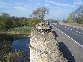
 The A428 bridge over the River Great Ouse at Turvey | ||||
| Route information | ||||
| Length | 82.9 mi[1] (133.4 km) | |||
| Major junctions | ||||
| Northwest end | Coventry 52°24′31″N 1°29′33″W / 52.4087°N 1.4925°W | |||
| Southeast end | Cambridge 52°13′55″N 0°04′40″E / 52.2319°N 0.0779°E | |||
| Location | ||||
| Country | United Kingdom | |||
| Primary destinations | Rugby Northampton Bedford Cambridge Coventry | |||
| Road network | ||||
| ||||
The A428 road is a major road in central and eastern England. It runs between the cities of Coventry and Cambridge by way of the county towns of Northampton and Bedford. Together with the A421, (and the A43, M40 and the A34), the eastern section (Cambridge to the A1) of the A428 forms the route between Cambridge and Oxford. The A428 was formerly part of the main route from Birmingham to Felixstowe before the A14 was fully opened in 1993.
- ^ "Directions to A428". Google Maps. Retrieved 11 April 2013.
