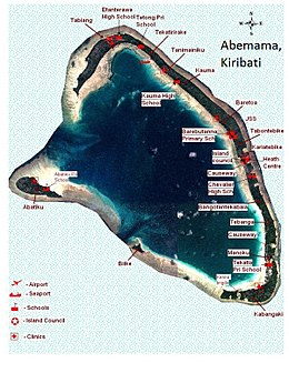
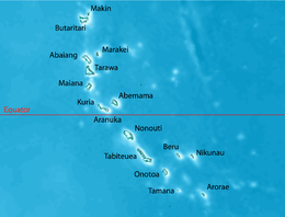
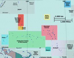
 Map of Abemama | |
 | |
| Geography | |
|---|---|
| Location | Pacific Ocean |
| Coordinates | 0°24′N 173°52′E / 0.400°N 173.867°E |
| Archipelago | Gilbert Islands |
| Area | 27.37 km2 (10.57 sq mi) |
| Highest elevation | 3 m (10 ft) |
| Administration | |
| Largest settlement | Kariatebike |
| Demographics | |
| Population | 3,262 (2015 Census) |
| Pop. density | 117/km2 (303/sq mi) |
| Ethnic groups | I-Kiribati 98.8% |
Abemama (Apamama)[1] is an atoll, one of the Gilberts group in Kiribati, and is located 152 kilometres (94 miles) southeast of Tarawa and just north of the Equator. Abemama has an area of 27.37 square kilometres (10.57 square miles) and a population of 3,299 as of 2015[update]. The islets surround a deep lagoon. The eastern part of the atoll of Abemama is linked together by causeways making automobile traffic possible between the different islets. The outlying islands of Abatiku and Biike are situated on the southwestern side of the atoll.[2]
The village of Kariatebike serves as the government center for the atoll[1] which includes an administration building, the police station and a hospital.
Abemama was formerly known as Roger Simpson Island,[3] Dundas Island, Hopper Island, or Simpson Island.[4]
- ^ a b Hoiberg, Dale H., ed. (2010). "Abemama Atoll". Encyclopædia Britannica. Vol. I: A-ak Bayes (15th ed.). Chicago, IL: Encyclopædia Britannica Inc. pp. 27. ISBN 978-1-59339-837-8.
- ^ "8. Abemama" (PDF). Office of Te Beretitent - Republic of Kiribati Island Report Series. 2012. Retrieved 28 April 2015.
- ^ Canby. Historic Places. p. 2
- ^ "Geody.com, Abemama". Retrieved 25 April 2013.


