| Abiquiu Dam | |
|---|---|
 | |
| Country | United States |
| Location | Rio Arriba County, New Mexico |
| Coordinates | 36°14′17″N 106°25′34″W / 36.23806°N 106.42611°W |
| Construction began | 1956 |
| Opening date | 1963 |
| Dam and spillways | |
| Type of dam | Embankment |
| Impounds | Rio Chama |
| Height | 354 ft (108 m)[1] |
| Length | 1,800 ft (550 m)[1] |
| Reservoir | |
| Creates | Abiquiu Lake |
| Total capacity | 1,369,000 acre⋅ft (1,689,000 dam3)[1] |
| Catchment area | 2,146 sq mi (5,560 km2)[1] |
| Power Station | |
| Operator(s) | County of Los Alamos[2] |
| Commission date | 1987–1990,[2] 2009–2011[3] |
| Turbines | 2x 6.75 MW 1x 3.0 MW[2] |
| Installed capacity | 16.5 MW[2] |
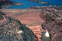
Abiquiu Dam is a dam on the Rio Chama, located about 60 miles (97 km) northwest of Santa Fe in Rio Arriba County, New Mexico, USA. Built and operated by the U.S. Army Corps of Engineers (USACE), the dam is an earth embankment structure 354 feet (108 m) high and 1,800 feet (550 m) long, containing 11.8 million cubic yards (9,022,000 m3) of fill.[1] The dam forms Abiquiu Lake, one of the largest lakes in New Mexico, with a full storage capacity of 1,369,000 acre-feet (1,689,000 dam3)[1] and 5,200 acres (2,100 ha) of water.[4] To date, the reservoir has never filled to capacity, with a record high of 402,258 acre-feet (496,178 dam3), 29.4% of full pool, on June 22, 1987.[5] The dam's primary purpose is flood control, in addition to irrigation and municipal water storage, and hydroelectric generation.
- ^ a b c d e f "Abiquiu Dam". National Performance of Dams Program. Stanford University. Archived from the original on 2016-03-06. Retrieved 2012-09-04.
- ^ a b c d "Hydroelectric Plants in Arizona & New Mexico". Power Plants Around The World. Industcards. 2011-05-08. Retrieved 2012-09-04.
- ^ "Installation of a Low‐Flow Turbine/Generator at the Abiquiu Hydroelectric Facility – Frequently Asked Questions (FAQs)" (PDF). Los Alamos County Department of Public Utilities. County of Los Alamos. October 2009. Archived from the original (PDF) on 2011-01-13. Retrieved 2012-09-04.
- ^ "Abiquiu Lake". Corps Lakes Gateway. U.S. Army Corps of Engineers. May 2012. Archived from the original on 2012-05-10. Retrieved 2012-09-04.
- ^ Hess-Britelle, Suzanne R. (2011-06-15). "Rock Blasting and Monitoring Adjacent to Critical Structures, Abiquiu Dam & Reservoir, New Mexico" (PDF). 2011 Infrastructure Systems Conference. U.S. Army Corps of Engineers. Retrieved 2012-09-04.