Abrantes | |
|---|---|
 | |
| Coordinates: 39°27′48″N 8°11′51″W / 39.46333°N 8.19750°W | |
| Country | |
| Region | Oeste e Vale do Tejo |
| Intermunic. comm. | Médio Tejo |
| District | Santarém |
| Parishes | 13 |
| Government | |
| • President | Manuel Jorge Valamatos (PS) |
| Area | |
| • Total | 714.69 km2 (275.94 sq mi) |
| Highest elevation | 315 m (1,033 ft) |
| Lowest elevation | 18 m (59 ft) |
| Population (2011) | |
| • Total | 39,325 |
| • Density | 55/km2 (140/sq mi) |
| Time zone | UTC+00:00 (WET) |
| • Summer (DST) | UTC+01:00 (WEST) |
| Postal code | 2200 |
| Area code | 241 |
| Patron | São Vicente/São João |
| Website | www |
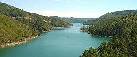
Abrantes (European Portuguese pronunciation: [ɐˈβɾɐ̃tɨʃ] ) is a municipality in the central Médio Tejo subregion of Portugal. The population as of 2011[update] was 39,325,[1] in an area of 714.69 square kilometres (275.94 sq mi).[2] The municipality includes several parishes divided by the Tagus River, which runs through the middle of the municipality. The urbanized part, the parish of Abrantes (São Vicente e São João) e Alferrarede, located on the north bank of the Tagus, has about 17,000 residents.
- ^ Instituto Nacional de Estatística
- ^ "Áreas das freguesias, concelhos, distritos e país". Archived from the original on 5 November 2018. Retrieved 5 November 2018.


