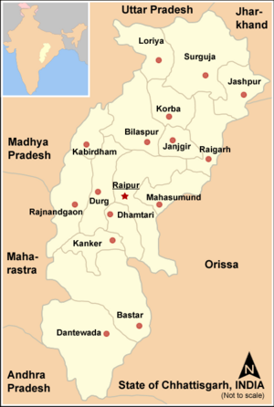
Abujhmarh is a hilly forest area, spread over 4,000 square kilometres (1,500 sq mi) in Chhattisgarh, covering Narayanpur district, Bijapur district and Dantewada district. It is home to indigenous tribes of India, including Gond, Muria, Abujhmarhia, Madiya, and Halba. It was only in 2009 that the Government of Chhattisgarh lifted the restriction on the entry of common people in the area imposed in the early 1980s. Geographically isolated and largely inaccessible, the area continues to show no physical presence of the civil administration, and is also known as "liberated-zone" as it is an alleged hub of Naxalite-Maoist insurgency, the banned Communist Party of India (Maoist) and its military wing, People's Liberation Guerilla Army (PLGA), who run a parallel government in the area.[1][2]
In 2007 the area was proposed as a biosphere reserve by Ministry of Environment and Forests, Government of India.
- ^ "Maoists butcher". Indian Express. 7 April 2010. Retrieved 2 June 2013.
the so-called liberated zone, including the Abujhmarh hills...
- ^ Cite error: The named reference
tehwas invoked but never defined (see the help page).