| Adare Peninsula | |
|---|---|
 Adare Peninsula | |
| Highest point | |
| Coordinates | 71°40′S 170°30′E / 71.667°S 170.500°E |
| Geography | |
| Geology | |
| Mountain type | Shield volcanoes |
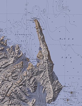
The Adare Peninsula (71°40′S 170°30′E / 71.667°S 170.500°E), is a high ice-covered peninsula, 40 nautical miles (74 km; 46 mi) long, in the northeast part of Victoria Land, extending south from Cape Adare to Cape Roget. The peninsula was named by the New Zealand Antarctic Place-Names Committee (NZ-APC) for Cape Adare.[1] The peninsula is considered the southernmost point of the Borchgrevink Coast, named for Carsten Borchgrevink (1864-1934).[citation needed]
- ^ Alberts 1995, p. 4.
