| Agery South Australia | |||||||||||||||
|---|---|---|---|---|---|---|---|---|---|---|---|---|---|---|---|
| Coordinates | 34°09′0″S 137°44′24″E / 34.15000°S 137.74000°E[1] | ||||||||||||||
| Population | 90 (SAL 2021)[2] | ||||||||||||||
| Established | 24 May 1999 (locality)[3] | ||||||||||||||
| Postcode(s) | 5558 | ||||||||||||||
| Elevation | 104 m (341 ft)[citation needed] | ||||||||||||||
| LGA(s) | Yorke Peninsula Council | ||||||||||||||
| Region | Yorke and Mid North[4] | ||||||||||||||
| County | Daly[1] | ||||||||||||||
| State electorate(s) | Narungga[5] | ||||||||||||||
| Federal division(s) | Grey[6] | ||||||||||||||
| |||||||||||||||
| Footnotes | Adjoining localities[1][7] | ||||||||||||||
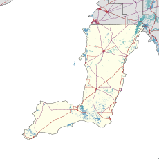
Agery is a locality in the Australian state of South Australia located on Yorke Peninsula. It is situated 17 km south-east of Moonta. Its name comes from the Aboriginal word ngadjali meaning "pipe clay".[8]
- ^ a b c "Search result(s) for Agery (LOCB) (Record No. SA0000379) with the following layers being selected - "Suburbs and Localities", "Counties", "Hundreds", "Place names (gazetteer)" and "Road labels"". Property Location Browser. Government of South Australia. Archived from the original on 12 October 2016. Retrieved 28 April 2017.
- ^ Australian Bureau of Statistics (28 June 2022). "Agery (suburb and locality)". Australian Census 2021 QuickStats. Retrieved 28 June 2022.
- ^ Kentish, Peter MacLaren (24 May 1999). "GEOGRAPHICAL NAMES ACT 1991, Notice to Assign Boundaries and Names to Places ( within the District Council of Yorke Peninsula)" (PDF). The South Australian Government Gazette. The South Australian Government. p. 2696. Retrieved 1 March 2018.
- ^ "Yorke and Mid North SA Government region" (PDF). The Government of South Australia. Retrieved 17 April 2017.
- ^ Narungga (Map). Electoral District Boundaries Commission. 2016. Retrieved 1 March 2018.
- ^ "Federal electoral division of Grey" (PDF). Australian Electoral Commission. Retrieved 24 July 2015.
- ^ "Development Plan, Copper Coast Council, Consolidated – 28 August 2014" (PDF). Department of Planning, Transport and Infrastructure. 2014. pp. 286 & 394. Retrieved 23 October 2015.[permanent dead link]
- ^ "Agery, (Place names of South Australia)". Place names of South Australia. State Library of South Australia. Retrieved 24 October 2015.
