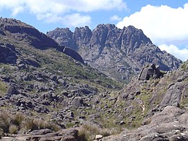
| Agulhas Negras Peak | |
|---|---|
 Summit | |
| Highest point | |
| Elevation | 2,791 m (9,157 ft) |
| Coordinates | 22°22′48″S 44°39′42″W / 22.38000°S 44.66167°W |
| Geography | |
| Location | Resende, Rio de Janeiro and Minas Gerais, Brazil |
| Parent range | Serra da Mantiqueira |
| Climbing | |
| First ascent | 1919 |
| Easiest route | By car from Rio de Janeiro or São Paulo on the Via Dutra highway up to Engenheiro Passos; from there on BR-354 highway toward Itamonte until the Garganta do Registro mountain pass; then on a gravel road (BR-485) to Itatiaia National Park's north entrance and from there to Abrigo Rebouças mountain shelter; easy trek to the peak base; steep climb on rock afterwards. |
Agulhas Negras Peak (Portuguese: Pico das Agulhas Negras, Portuguese pronunciation: [ˈpiku daz aˈɡuʎɐz ˈneɡɾɐs], lit. 'Black Needles Peak') is the fifth-highest mountain in Brazil,[Note 1] standing at 2,791 metres (9,157 ft) above sea level, making it one of the highest in the Brazilian Highlands.[3] It is located in Itatiaia National Park, in the Mantiqueira range, on the border of the states of Rio de Janeiro and Minas Gerais. It is the highest point in the state of Rio de Janeiro, the third-highest in Minas Gerais, and the second-highest in the Mantiqueira range.[1]
The climb to the top of the mountain was first attempted by Franklin Massena in the year 1856. Further attempts were made by André Rebouças in 1878 and by Horácio de Carvalho in 1898, but the summit was only reached by Carlos Spierling and Osvaldo Leal in 1919.[4]
- ^ a b Brazilian Institute of Geography and Statistics (IBGE) (2014). Anuário Estatístico do Brasil 2014 [2014 Statistical Yearbook of Brazil] (in Portuguese). Vol. 74. Rio de Janeiro: Brazilian Institute of Geography and Statistics (IBGE). p. 33. ISSN 0100-1299.
- ^ "Após nova medição, Pico da Neblina ganha 1,52 metros a mais" [After new measurement, Pico da Neblina becomes 1.52 metre higher]. Alta Montanha (in Portuguese). 2016-02-29. Archived from the original on 2016-07-01. Retrieved 2016-05-30.
- ^ IBGE Pontos Culminantes
- ^ DOCUMENTAÇÃO DE IMAGENS DE MONTANHA - PARTE 4 IMAGENS BRASILEIRAS - Blog do Dubois
Cite error: There are <ref group=Note> tags on this page, but the references will not show without a {{reflist|group=Note}} template (see the help page).
