Ahipara | |
|---|---|
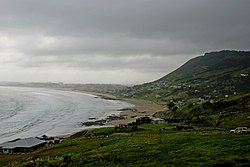
 Ahipara Bay with Whangatauatia Maunga to the right | |
 | |
| Coordinates: 35°10′17″S 173°9′12″E / 35.17139°S 173.15333°E | |
| Country | New Zealand |
| Region | Northland Region |
| District | Far North District |
| Ward | Te Hiku |
| Community | Te Hiku |
| Subdivision | Kaitāia |
| Electorates | |
| Government | |
| • Territorial Authority | Far North District Council |
| • Regional council | Northland Regional Council |
| Area | |
| • Total | 4.53 km2 (1.75 sq mi) |
| Population (June 2023)[2] | |
| • Total | 1,450 |
| • Density | 320/km2 (830/sq mi) |
| Postcode | 0481 |
Ahipara is a town and locality in Northland, New Zealand at the southern end of Ninety Mile Beach, with the Tauroa Peninsula to the west and Herekino Forest to the east. Ahipara Bay is to the north west. Kaitaia is 14 km to the north east,[3] and Pukepoto is between the two.
- ^ Cite error: The named reference
Areawas invoked but never defined (see the help page). - ^ "Population estimate tables - NZ.Stat". Statistics New Zealand. Retrieved 25 October 2023.
- ^ "Northland places". Te Ara: The Encyclopedia of New Zealand.