| Aighton, Bailey and Chaigley | |
|---|---|
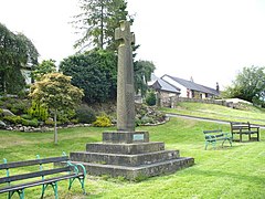
 Boer War Memorial at Hurst Green | |
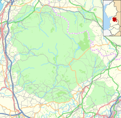
Location within Lancashire | |
| Area | 25.4318 km2 (9.8193 sq mi) |
| Population | 1,307 (2011)[1] |
| • Density | 51/km2 (130/sq mi) |
| OS grid reference | SD6837 |
| District | |
| Shire county | |
| Region | |
| Country | England |
| Sovereign state | United Kingdom |
| Post town | CLITHEROE |
| Postcode district | BB7 |
| Dialling code | 01254 |
| Police | Lancashire |
| Fire | Lancashire |
| Ambulance | North West |
| UK Parliament | |
Aighton, Bailey and Chaigley is a civil parish in the Borough of Ribble Valley in Lancashire, England, just west of Clitheroe. The population of the civil parish at the 2011 census was 1,307,[1] an increase from 1,249 in 2001.[2]
The main settlements in the parish are Hurst Green and Walker Fold. Other places are Aighton, Bailey and Chaigley, originally three hamlets forming a township. Stonyhurst College is located near to Hurst Green, within the parish.
- ^ a b UK Census (2011). "Local Area Report – Aighton, Bailey and Chaigley Parish (1170215092)". Nomis. Office for National Statistics. Retrieved 26 February 2018.
- ^ Office for National Statistics : Census 2001 : Parish Headcounts : Ribble Valley Archived 3 March 2016 at the Wayback Machine Retrieved 31 July 2010


