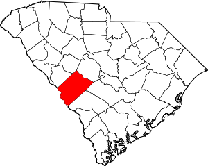
Aiken County | |
|---|---|
 Aiken County Courthouse and Confederate Monument | |
 Location within the U.S. state of South Carolina | |
 South Carolina's location within the U.S. | |
| Coordinates: 33°33′N 81°38′W / 33.55°N 81.63°W | |
| Country | |
| State | |
| Founded | 1871 |
| Named for | William Aiken |
| Seat | Aiken |
| Largest community | Aiken |
| Area | |
• Total | 1,080.17 sq mi (2,797.6 km2) |
| • Land | 1,070.69 sq mi (2,773.1 km2) |
| • Water | 9.48 sq mi (24.6 km2) 0.88% |
| Population (2020) | |
• Total | 168,808 |
• Estimate (2023) | 177,130 |
| • Density | 157.66/sq mi (60.87/km2) |
| Time zone | UTC−5 (Eastern) |
| • Summer (DST) | UTC−4 (EDT) |
| Congressional district | 2nd |
| Website | www |
Aiken County (/ˈeɪkən/) is a county in the U.S. state of South Carolina. As of the 2020 census, its population was 168,808.[1] Its county seat and largest community is Aiken.[2] Aiken County is a part of the Augusta-Richmond County, GA-SC Metropolitan Statistical Area. It is mostly in the Sandhills region, with the northern parts reaching in the Piedmont and southern parts reaching into the Coastal Plain.
- ^ Cite error: The named reference
2020CensusQuickFactswas invoked but never defined (see the help page). - ^ "Find a County". National Association of Counties. Archived from the original on May 31, 2011. Retrieved June 7, 2011.
