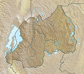
| Akagera National Park | |
|---|---|
 | |
| Location | Rwanda |
| Coordinates | 01°38′S 30°47′E / 1.633°S 30.783°E |
| Area | 1,122 km2 (433 sq mi) |
| Created | 1934 |
Akagera National Park is a protected area in eastern Rwanda covering 1,122 km2 (433 sq mi) along the international border with Tanzania. It was founded in 1934 and includes savannah, montane and swamp habitats. The park is named for the Kagera River which flows along its eastern boundary feeding into Lake Ihema and several smaller lakes. The complex system of lakes and linking papyrus swamps makes up over a third of the park, which is the largest protected wetland in Eastern-Central Africa.
