Aktau
Aqtau / Ақтау (Kazakh) | |
|---|---|
|
From top left to down right: Skyline of Aktau, the Rocky shore of the Caspian Sea, The Lighthouse, Main Street leading to the Port with the Caspian Sea in the background. | |
| Coordinates: 43°39′09″N 51°09′27″E / 43.65250°N 51.15750°E | |
| Country | Kazakhstan |
| Region | Mangystau Region |
| Founded | 1958 |
| Government | |
| • Akim (mayor) | Abilkair Baipakov[1] |
| Area | |
| • Total | 77 km2 (30 sq mi) |
| Elevation | −8 m (−26 ft) |
| Population (2023)[2] | |
| • Total | 270,886 |
| • Density | 3,500/km2 (9,100/sq mi) |
| Time zone | UTC+5 (UTC+5) |
| Postal code | 130000 |
| Area code | +7 7292 |
| Vehicle registration | 12, R |
| HDI (2019) | 0.804[3] high · 4 |
| GDP (nominal) | 2022 |
| • Total | (KZT 4 401 192,9 million)[4] |
| • Per capita | (KZT 5 817,8 thousand) |
| Website | aktau |
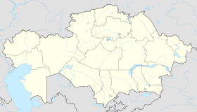
Aktau (/ˌɑːkˈtaʊ/; Kazakh: Aqtau / Ақтау [ɑqˈtɑw] ()) is a city in south-west Kazakhstan, located on the eastern shore of the Caspian Sea. Its name means 'white mountain' in the Kazakh language, which may be due to its cliffs that overlook the Caspian. From 1964 to 1991, the city was known as Shevchenko, which was given due to the eponymous Ukrainian poet's period of exile in the area.[5] It is located on the Mangyshlak Peninsula and is the capital of the Mangystau Region.
Aktau is known for its unique block address system. Almost no streets in Aktau have names; instead, addresses generally consist of three numbers: the district number (also known as micro-region/micro-district/block), the building number, and the apartment number. This is because Aktau was originally planned as a camp for the workers of the oil industry.[6][failed verification]
- ^ "New mayor of Aktau named". inform.kz. July 16, 2024.
- ^ Об изменении численности населения Мангистауской области в разрезе городов и районов с 1 января 2023 года до 1 сентября 2023 года [On changes in the population of the Mangystau Region by city and district from January 1, 2023 to September 1, 2023] (in Russian). Committee on Statistics of Ministry of National Economy of the Republic of Kazakhstan. Retrieved October 15, 2023.
- ^ "Sub-national HDI – Area Database – Global Data Lab". hdi.globaldatalab.org. Archived from the original on September 23, 2018. Retrieved July 21, 2021.
- ^ DOSM. "Department of Statistics Kazakhstan". stat.gov.kz. Archived from the original on January 2, 2024. Retrieved March 1, 2023.
- ^ "Aktau city, Kazakhstan facts, history, attractions, photos". About Kazakhstan. Retrieved December 29, 2015.
- ^ "Aktau: Years, people, memories". Ogni. October 13, 2011. Archived from the original on June 18, 2018. Retrieved July 4, 2012.


