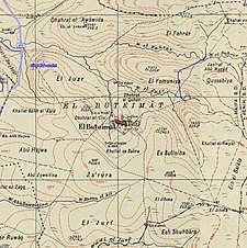
Al-Butaymat
البطيمات Buteimat, al-Buteimat | |
|---|---|
Village | |
| Etymology: "the place with the terebinths."[1] | |
A series of historical maps of the area around Al-Butaymat (click the buttons) | |
Location within Mandatory Palestine | |
| Coordinates: 32°33′12″N 35°5′38″E / 32.55333°N 35.09389°E | |
| Palestine grid | 159/217 |
| Geopolitical entity | Mandatory Palestine |
| Subdistrict | Haifa |
| Date of depopulation | May 1948[4] |
| Population (1945) | |
| • Total | 110[2][3] |
| Cause(s) of depopulation | Fear of being caught up in the fighting |
| Current Localities | Gal'ed[5] Former: Regavim[6] |
Al-Butaymat (Arabic: البطيمات, El Buteimât) was a Palestinian Arab village the Haifa Subdistrict, located 31 kilometers (19 mi) southeast of Haifa. It was depopulated during the 1947–48 Civil War in Mandatory Palestine on May 1, 1948, under the Battle of Mishmar HaEmek.
- ^ Palmer, 1881, p. 154
- ^ Department of Statistics, 1945, p. 13
- ^ Government of Palestine, Department of Statistics. Village Statistics, April, 1945. Quoted in Hadawi, 1970, p. 47 Archived 2016-03-03 at the Wayback Machine
- ^ Morris, 2004, p. xviii village #156. Also gives cause of depopulation, but cause indicated in brackets by a question mark.
- ^ Khalidi, 1992, p. 157
- ^ Morris, 2004, p. xx, settlement #15, July, 1948. Moved to the land of Qannir in 1949.


