Al-Maghar
المغار | |
|---|---|
 Al-Maghar, 1940 | |
| Etymology: The caves[1] | |
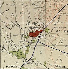
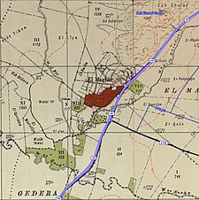
A series of historical maps of the area around Al-Maghar (click the buttons) | |
Location within Mandatory Palestine | |
| Coordinates: 31°50′19″N 34°46′56″E / 31.83861°N 34.78222°E | |
| Palestine grid | 129/138 |
| Geopolitical entity | Mandatory Palestine |
| Subdistrict | Ramle |
| Date of depopulation | 18 May 1948[4] |
| Area | |
| • Total | 15,390 dunams (15.39 km2 or 5.94 sq mi) |
| Population (1945) | |
| • Total | 1,740[2][3] |
| Cause(s) of depopulation | Military assault by Yishuv forces |
| Current Localities | Beit Elazari[5] |
Al-Maghar was a Palestinian Arab village in the Ramle Subdistrict of Mandatory Palestine. It was depopulated by the Givati Brigade during Operation Barak on 18 May 1948. It was located 12 km southwest of Ramla, situated north of Wadi al-Maghar.
- ^ Palmer, 1881, p. 272
- ^ Government of Palestine, Department of Statistics, 1945, p. 30
- ^ a b Government of Palestine, Department of Statistics. Village Statistics, April, 1945. Quoted in Hadawi, 1970, p. 67
- ^ Morris, 2004, p. xix village #256. Also gives cause of depopulation
- ^ Khalidi, 1992, p. 395


