al-Manshiyya
المنشيه | |
|---|---|
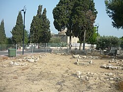
 Ancient tomb of Abu Ataba, now the residential home of a Jewish family. | |
A series of historical maps of the area around Al-Manshiyya, Acre (click the buttons) | |
Location within Mandatory Palestine | |
| Coordinates: 32°55′56″N 35°05′26″E / 32.93222°N 35.09056°E | |
| Palestine grid | 159/260 |
| Geopolitical entity | Mandatory Palestine |
| Subdistrict | Acre |
| Date of depopulation | 14 May 1948 (Operation Ben-Ami)[3] |
| Area | |
| • Total | 14,886 dunams (14.886 km2 or 5.748 sq mi) |
| Population (1945) | |
| • Total | 810[1][2] |
| Cause(s) of depopulation | Military assault by Yishuv forces |
| Current Localities | Shomrat,[4] Bustan HaGalil[4] |
Al-Manshiyya (Arabic: المنشية),[5] was a Palestinian village with a Muslim orphanage and a mosque known as the mosque of Abu 'Atiyya, which is still standing.
The area just north of the village was a garden planted by Sulayman Pasha, who was the ruler of Acre in the early 19th century, named Arabic: قصر بهجي, Qasr Bahjī, mansion of delight; today this is known as the shrine of Bahá'u'lláh, who was the founder of the Baháʼí Faith.
- ^ Government of Palestine, Department of Statistics, 1945, p. 4
- ^ a b Government of Palestine, Department of Statistics. Village Statistics, April, 1945. Quoted in Hadawi, 1970, p. 40 Archived 15 September 2018 at the Wayback Machine
- ^ Morris, 2004 p. xvii Archived 22 December 2019 at the Wayback Machine, village #88 Also gives the cause for depopulation
- ^ a b Khalidi, 1992, p. 23
- ^ Palmer, 1881, p. 52 Archived 6 July 2017 at the Wayback Machine


