al-Masmiyya al-Saghira
المسمية الصغيرة Masmiyyat al-Hurani al-Huraniyya | |
|---|---|
Village | |
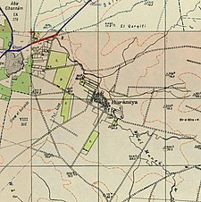
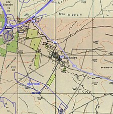
A series of historical maps of the area around Al-Masmiyya al-Saghira (click the buttons) | |
Location within Mandatory Palestine | |
| Coordinates: 31°45′10″N 34°47′56″E / 31.75278°N 34.79889°E | |
| Palestine grid | 131/128 |
| Geopolitical entity | Mandatory Palestine |
| Subdistrict | Gaza |
| Date of depopulation | July 8–9, 1948[3] |
| Area | |
| • Total | 6,478 dunams (6.478 km2 or 2.501 sq mi) |
| Population (1945) | |
| • Total | 530[1][2] |
| Cause(s) of depopulation | Military assault by Yishuv forces |
| Current Localities | Masmiya Bet,[4] Kfar HaRif[5] |
Al-Masmiyya al-Saghira (Arabic: المسمية الصغيرة), also known as Mamsiyyat al-Hurani and al-Huraniyya, was a Palestinian Arab village in the Gaza Subdistrict, located 42 kilometers (26 mi) northeast of Gaza. It was situated at an elevation of 60 meters (200 ft) in the southern coastal plain of Ottoman Syria.
Established in the late 19th century by people of Haurani descent,[5][6] Al-Masmiyya al-Saghira was depopulated during the 1948 Arab-Israeli War, but prior to that, in 1945, it had a population of 530 inhabitants.[5]
- ^ Government of Palestine, Department of Statistics, 1945, p. 32
- ^ a b Government of Palestine, Department of Statistics. Village Statistics, April, 1945. Quoted in Hadawi, 1970, p. 46
- ^ Morris, 2004, p. xix, village #274. Also gives the cause for depopulation.
- ^ also known as Masmiya Shalom. Morris, 2004, p. xxi, settlement #72, established in 1949
- ^ a b c Khalidi, 1992, p. 126
- ^ גרוסמן, דוד; Grossman, David (1987). "Rural Settlement in the Southern Coastal Plain and the Shefelah, 1835-1945 / היישוב הכפרי במישור-פלשת ובשפלה הנמוכה, 1835-1945". Cathedra: For the History of Eretz Israel and Its Yishuv / קתדרה: לתולדות ארץ ישראל ויישובה (45): 64. ISSN 0334-4657.


