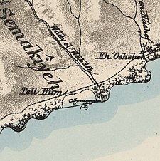
Al-Samakiyya
تلحوم/السمكية | |
|---|---|
Village | |
 Al-Samakiyya villagers, postcard from 1902 | |
| Etymology: ’Arab es Semakîyeh, the Semakîyeh (fisher) Arabs[1] | |
A series of historical maps of the area around Al-Samakiyya (click the buttons) | |
Location within Mandatory Palestine | |
| Coordinates: 32°53′02″N 35°34′41″E / 32.88389°N 35.57806°E | |
| Palestine grid | 204/254 |
| Geopolitical entity | Mandatory Palestine |
| Subdistrict | Tiberias |
| Date of depopulation | Not known[4] |
| Area | |
| • Total | 10,526 dunams (10.526 km2 or 4.064 sq mi) |
| Population (1945) | |
| • Total | 330 Muslims and 50 Christians connected to Capernaum ecclesiastic sites[2][3] |
| Current Localities | Amnun,[5] Korazim[5] |
Al-Samakiyya was a Palestinian Arab village in the Tiberias Subdistrict. It was depopulated during the 1947–1948 Civil War in Mandatory Palestine on May 4, 1948, under Operation Matateh. It was located 11 km northeast of Tiberias, near the Wadi al-Wadabani. The village was located at Tel Hum, which has been identified with Capernaum.[6]
- ^ Palmer, 1881, p. 123
- ^ Department of Statistics, 1945, p. 12
- ^ a b Government of Palestine, Department of Statistics. Village Statistics, April, 1945. Quoted in Hadawi, 1970, p. 72
- ^ Morris, 2004, p. xvii, village #373. Gives both date and cause of depopulation as "Not known"
- ^ a b Khalidi, 1992, p. 539
- ^ Conder and Kitchener, 1881, SWP I, pp. 371, 417


