| Alamo Canal | |
|---|---|
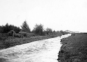
 Original caption: View on Main Canal -- Note High Velocity | |
| Specifications | |
| Maximum height above sea level | 125 ft (38 m) |
| Status | Closed/partially infilled |
| History | |
| Former names | Imperial |
| Original owner | California Development Company |
| Principal engineer | Charles R. Rockwood[1] |
| Other engineer(s) | George Chaffey |
| Construction began | April 3, 1900 |
| Date of first use | May 14, 1901 |
| Date closed | 1942[2] |
| Geography | |
| Start point | Near Pilot Knob 32°44′24″N 114°42′39″W / 32.740137°N 114.710795°W, Imperial County, California, USA |
| End point | Head of Alamo River 32°38′31″N 114°51′21″W / 32.642064°N 114.855938°W, Mexicali Municipality, Baja California, Mexico |
| Connects to | Alamo River |
The Alamo Canal (Spanish: Canal del Álamo) was a 14 mi (23 km) long waterway that connected the Colorado River to the head of the Alamo River.[3] The canal was constructed to provide irrigation to the Imperial Valley. A small portion of the canal was located in the United States but the majority of the canal was located in Mexico. The Alamo Canal is also known as the Imperial Canal.[4]
- ^ Laflin, Pat. "THE SALTON SEA CALIFORNIA'S OVERLOOKED TREASURE" (PDF). Coachella Valley Historical Society. Archived from the original (PDF) on 3 June 2010. Retrieved 1 June 2010.
- ^ "AAC History". Imperial Irrigation District. 2006. Archived from the original on 17 October 2010. Retrieved 1 June 2010.
- ^ Cite error: The named reference
taitwas invoked but never defined (see the help page). - ^ Gupta, Avijit (2008). Large rivers: geomorphology and management. Wiley. p. 208. ISBN 978-0-470-84987-3. Retrieved 2 June 2010.