Alamogordo, New Mexico | |
|---|---|
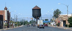
Downtown Alamogordo, looking west on 10th Street; Jim Griggs Sports Complex; Shops on New York Avenue; Water Tower looking east on Tenth Street; Kids' Kingdom Park; View of Alamogordo from Thunder Road | |
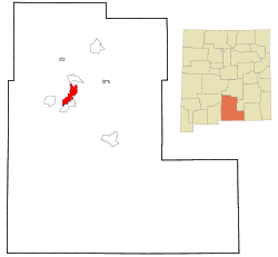
 Location in New Mexico | |
| Coordinates: 32°51′22″N 105°58′28″W / 32.85611°N 105.97444°W[3] | |
| Country | United States |
| State | New Mexico |
| County | Otero[1][2] |
| Founded | 1898 |
| Incorporated | 1912 |
| Named for | álamo gordo, Spanish for "fat cottonwood" |
| Government | |
| • Type | Commission–manager |
| • Mayor | Susan Payne[4] |
| • Mayor Pro Tem | Al Hernandez[4] |
| • City Manager | Maggie Paluch[5] |
| Area | |
| • Total | 21.58 sq mi (55.90 km2) |
| • Land | 21.57 sq mi (55.87 km2) |
| • Water | 0.01 sq mi (0.03 km2) |
| Elevation | 4,311 ft (1,314 m) |
| Population | |
| • Total | 31,384 |
| • Density | 1,432.32/sq mi (553.02/km2) |
| Time zone | UTC−7 (Mountain Standard Time Zone) |
| • Summer (DST) | UTC−6 (Mountain Daylight Time) |
| ZIP codes[8] | 88310, 88311 (PO Box) |
| Area code | 575 |
| FIPS code | 35-01780 |
| GNIS feature ID | 2409672[3] |
| Website | ci |
Alamogordo (/ˌæləməˈɡɔːrdoʊ/) is the County seat of Otero County, New Mexico, United States. A city in the Tularosa Basin of the Chihuahuan Desert, it is bordered on the east by the Sacramento Mountains and to the west by Holloman Air Force Base. The population was 31,384 as of the 2020 census. Alamogordo is widely known for its connection with the 1945 Trinity test, which was the first ever explosion of an atomic bomb.
Humans have lived in the Alamogordo area for at least 11,000 years. The present settlement, established in 1898 to support the construction of the El Paso and Northeastern Railroad, is an early example of a planned community. The city was incorporated in 1912. Tourism became an important economic factor with the creation of White Sands National Monument in 1933, which is still one of the biggest attractions of the city today. During the 1950s–60s, Alamogordo was an unofficial center for research on pilot safety and the developing United States' space program.
Alamogordo is a charter city with a council-manager form of government. City government provides a large number of recreational and leisure facilities for its citizens, including a large park in the center of the city, many smaller parks scattered through the city, a golf course, Alameda Park Zoo, a network of walking paths, Alamogordo Public Library, and a senior citizens' center. Gerald Champion Regional Medical Center is a nonprofit shared military/civilian facility that is also the hospital for Holloman Air Force Base.
- ^ "US Board on Geographic Names". United States Geological Survey. October 25, 2007. Retrieved January 31, 2008.
- ^ "Find a County". National Association of Counties. Archived from the original on May 31, 2011. Retrieved June 7, 2011.
- ^ a b c U.S. Geological Survey Geographic Names Information System: Alamogordo, New Mexico
- ^ a b "New Mayor, City Commission sworn into office". alamogordonews.com.
- ^ "City Commission names Maggie Paluch as City Manager". alamogordonews.com.
- ^ "ArcGIS REST Services Directory". United States Census Bureau. Retrieved October 12, 2022.
- ^ Cite error: The named reference
USCensusDecennial2020CenPopScriptOnlywas invoked but never defined (see the help page). - ^ "ZIP Code Lookup". United States Postal Service. Archived from the original (JavaScript/HTML) on January 1, 2008. Retrieved January 1, 2008.


