Alandroal | |
|---|---|
 A profile of Alandroal showing the parochial church and low-lying buildings | |
 | |
| Coordinates: 38°37′N 7°24′W / 38.617°N 7.400°W | |
| Country | |
| Region | Alentejo |
| Intermunic. comm. | Alentejo Central |
| District | Évora |
| Parishes | 4 |
| Government | |
| • President | João Maria Aranha Grilo (PS) |
| Area | |
| • Total | 542.68 km2 (209.53 sq mi) |
| Elevation | 341 m (1,119 ft) |
| Population (2011) | |
| • Total | 5,843 |
| • Density | 11/km2 (28/sq mi) |
| Time zone | UTC+00:00 (WET) |
| • Summer (DST) | UTC+01:00 (WEST) |
| Postal code | 7250 |
| Patron | Nossa Senhora da Boa Nova |
| Website | http://www.cm-alandroal.pt |
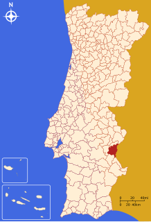
Alandroal (Portuguese pronunciation: [ɐlɐ̃dɾuˈal] ) is a municipality in the Portuguese district of Évora located on the eastern frontier with Spain along the right margin of the Guadiana River in the Central Alentejo region. It is located 341 metres (1,119 ft) above sea level, northeast of Évora and southeast of Estremoz. The population in 2011 was 5,843,[1] in an area of 542.68 km2.[2]
- ^ Instituto Nacional de Estatística
- ^ "Áreas das freguesias, concelhos, distritos e país". Archived from the original on 2018-11-05. Retrieved 2018-11-05.

