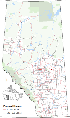
Segments of Highway 16A in Alberta | ||||
| Route information | ||||
| Auxiliary route of Highway 16 | ||||
| Maintained by Alberta Transportation | ||||
| Evansburg – Entwistle segment | ||||
| Length | 13.6 km[1] (8.5 mi) | |||
| West end | ||||
| Major intersections | ||||
| East end | ||||
| Parkland Highway | ||||
| Length | 34.8 km[2] (21.6 mi) | |||
| West end | ||||
| Major intersections | ||||
| East end | ||||
| Vegreville segment | ||||
| Length | 9.5 km[3] (5.9 mi) | |||
| West end | ||||
| East end | ||||
| Location | ||||
| Country | Canada | |||
| Province | Alberta | |||
| Specialized and rural municipalities | Yellowhead County, Parkland County, County of Minburn No. 27 | |||
| Major cities | Edmonton, Spruce Grove | |||
| Towns | Stony Plain, Vegreville | |||
| Highway system | ||||
|
| ||||
| ||||
Highway 16A is the designation of three alternate routes off Alberta Highway 16 (the Yellowhead highway) in Alberta, Canada. The Evansburg – Entwistle section is called 16A:08 by Alberta Transportation, while 16A:24 runs through Vegreville. The section west of Edmonton is labelled 16A:14 and 16A:16 on Alberta Transportation maps, but is better known as Parkland Highway and Stony Plain Road.
- ^ "Highway 16A through Evansburg/Entwistle" (Map). Google Maps. Retrieved January 10, 2017.
- ^ "Parkland Highway" (Map). Google Maps. Retrieved January 10, 2017.
- ^ "Highway 16A through Vegreville" (Map). Google Maps. Retrieved January 10, 2017.

