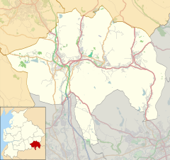
Alden Valley, Helmshore
| |
|---|---|
 Alden from Stake Lane | |
Location within Lancashire | |
| OS grid reference | SD772197 |
| District | |
| Shire county | |
| Region | |
| Country | England |
| Sovereign state | United Kingdom |
| Post town | ROSSENDALE |
| Postcode district | BB4 |
| Dialling code | 01706 |
| Police | Lancashire |
| Fire | Lancashire |
| Ambulance | North West |
| UK Parliament | |
The Alden Valley is a small valley on the eastern edge of the West Pennine Moors, west of Helmshore in Rossendale, Lancashire, England. In the 14th century it was part of the Earl of Lincoln's hunting park. By 1840 it was home to about twenty farms, largely involved in cattle rearing, although most inhabitants were also involved with the production of textiles, which quickly developed during the Industrial Revolution into the building of textile mills. These have now been demolished and the valley is dominated by sheep grazing, with three working farms and a number of smallholdings.[1]
To the north and north-west is Musbury Tor, to the south-west at the head of the valley is Scholes Height, to the west is Musden Head Moor and Burnt Hill. To the south is Bull Hill and the Holcombe Moor, to the south-east is Beetle Hill. Alden Brook forms from several streams draining Wet Moss on the north-western slopes of Scholes Height, which join after flowing through several gullies at an area known as Alden Ratchers. It is the last of the River Ogden's tributaries to join before it joins the River Irwell.[2]
- ^ Simpson, John (2008). Musbury and Alden: 700 years of life and landscape. Helmshore Local History Society. ISBN 978-0-906881-19-4.
- ^ "287" (Map). West Pennine Moors. 1:25,000. Explorer. Ordnance Survey. 2016. ISBN 978-0-319-26201-6.

