This article needs additional citations for verification. (March 2013) |
Alveringem | |
|---|---|
 Saint Audomar Church in Alveringem | |
| Coordinates: 51°01′N 02°43′E / 51.017°N 2.717°E | |
| Country | |
| Community | Flemish Community |
| Region | Flemish Region |
| Province | West Flanders |
| Arrondissement | Veurne |
| Government | |
| • Mayor | Gerard Liefooghe (Gemeentebelangen) |
| • Governing party/ies | Gemeentebelangen, CD&V |
| Area | |
| • Total | 80.71 km2 (31.16 sq mi) |
| Population (2018-01-01)[1] | |
| • Total | 5,089 |
| • Density | 63/km2 (160/sq mi) |
| Postal codes | 8690, 8691 |
| NIS code | 38002 |
| Area codes | 058 |
| Website | www.alveringem.be |
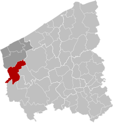
Alveringem (Dutch pronunciation: [ˈɑlvərɪŋ(ɣ)ɛm] ; West Flemish: Oalveringem) is a municipality located in the Belgian province of West Flanders. The municipality comprises the towns of Alveringem proper, Beveren-aan-de-IJzer, Gijverinkhove, Hoogstade, Izenberge, Leisele, Oeren, Sint-Rijkers and Stavele. On January 1, 2006, Alveringem had a total population of 4,887. The total area is 80.01 km² which gives a population density of 61 inhabitants per km². The mayor of Alveringem is Gerard Liefooghe (Gemeentebelangen) since 2006.
Cyriel Verschaeve was as a priest attached to the parish of Alveringem and re-buried near Alveringem's church in 1973.
- ^ "Wettelijke Bevolking per gemeente op 1 januari 2018". Statbel. Retrieved 9 March 2019.


