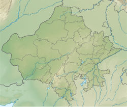
Alwar | |
|---|---|
City | |
 Scenic view of Alwar city (RJ) from Bala Qila | |
| Nickname: Scotland of Rajasthan | |
| Coordinates: 27°32′59″N 76°38′08″E / 27.549780°N 76.635539°E | |
| Country | |
| State | Rajasthan |
| District | Alwar |
| Government | |
| • Type | Municipal Corporation |
| • Body | Alwar Municipal Corporation |
| Area | |
| • City | 147 km2 (57 sq mi) |
| Elevation | 268 m (879 ft) |
| Population (2024) | |
| • City | 505,000 |
| • Rank | 8th in Rajasthan |
| • Density | 3,400/km2 (8,900/sq mi) |
| • Metro | 583,000 |
| Demonym | Alwariya |
| Languages | |
| • Official | Hindi |
| • Regional | Ahirwati, Rajasthani, Mewati |
| Time zone | UTC+5:30 (IST) |
| PIN | 301001, 301002 |
| ISO 3166 code | RJ-IN |
| Vehicle registration | RJ-02 |
| Website | Alwar Municipal Corporation Alwar District |
Alwar (Rajasthani Pronunciation: [əlʋəɾ]) is a city located in India's National Capital Region (NCR) and the administrative headquarters of Alwar District in the state of Rajasthan. It is located 150 km south of Delhi and 150 km north of Jaipur.Its was ruled by Gurjars in past.

