Amanit | |
|---|---|
Tabia | |
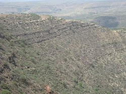
 Slopes with incense trees at the lower end of Amanit | |
| Coordinates: 13°33′N 39°15′E / 13.550°N 39.250°E | |
| Country | Ethiopia |
| Region | Tigray |
| Zone | Debub Misraqawi (Southeastern) |
| Woreda | Dogu'a Tembien |
| Area | |
| • Total | 60.61 km2 (23.40 sq mi) |
| Elevation | 1,900 m (6,200 ft) |
| Time zone | UTC+3 (EAT) |
Amanit is a tabia or municipality in the Dogu'a Tembien district of the Tigray Region of Ethiopia. The tabia centre is Addi Qeshofo village, located approximately 15 km to the southeast of the woreda town Hagere Selam (as the crow flies).
