| Ampato | |
|---|---|
 | |
| Highest point | |
| Elevation | 6,288 m (20,630 ft) |
| Prominence | 1,997 m (6,552 ft) |
| Listing | Ultra |
| Coordinates | 15°49′S 71°53′W / 15.817°S 71.883°W |
| Geography | |
| Location | Arequipa, Peru |
| Parent range | Andes |
| Geology | |
| Rock age | Pleistocene |
| Mountain type | Stratovolcano |
| Volcanic belt | Central Volcanic Zone |
| Last eruption | Unknown |
| Climbing | |
| First ascent | Inca, pre-Columbian |
| Easiest route | snow / glacier climb |
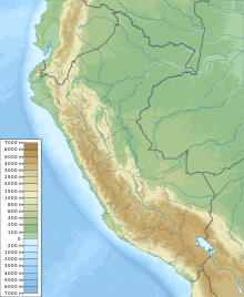
Ampato (possibly from Quechua hamp'atu[1] or from Aymara jamp'atu,[2] both meaning "frog") is a dormant 6,288-metre (20,630 ft) stratovolcano in the Andes of southern Peru. It lies about 70–75 kilometres (43–47 mi) northwest of Arequipa and is part of a north-south chain that includes the volcanoes Hualca Hualca and Sabancaya, the last of which has been historically active.
Ampato consists of three volcanic cones, which lie on top of an older eroded volcanic edifice. They were formed sequentially by extrusion of lava flows, but Ampato has also had explosive eruptions which have deposited ash, lapilli and pumice in the surrounding landscape. One young lava flow has been dated to 17,000 ± 6,000 years before present, but a summit lava dome is even younger, and Holocene ash layers in surrounding peat bogs may testify to the occurrence of recent eruptions.
The present-day volcano is covered by an ice cap, and during the last glacial maximum glaciers advanced to low altitudes. In 1995, an Inca mummy known as Mummy Juanita was discovered on Ampato by Johan Reinhard; it had been offered as a human sacrifice more than six hundred years earlier on the mountain.
- ^ Yachakuqkunapa Simi Qullqa - Qusqu Qullaw. Qhichwa Simipi (monolingual Quechua and bilingual Quechua-Spanish dictionary)
- ^ Radio San Gabriel, "Instituto Radiofonico de Promoción Aymara" (IRPA) 1993, Republicado por Instituto de las Lenguas y Literaturas Andinas-Amazónicas (ILLLA-A) 2011, Transcripción del Vocabulario de la Lengua Aymara, P. Ludovico Bertonio 1612 (Spanish-Aymara-Aymara-Spanish dictionary)
