Anders Bure | |
|---|---|
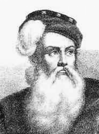
 Later depiction of Anders Bure; no contemporary portraits exist of him.[1] | |
| Born | Andreas Bureus 14 August 1571 |
| Died | 4 February 1646 or 24 February 1646 (aged 74) |
| Spouse |
Kjerstin Krabbe (m. 1604) |
| Family | Bure kinship |
Anders Bure (before his ennoblement Andreas Bureus; 14 August 1571 – 4 February 1646)[a] was a Swedish cartographer, considered the "father of Swedish cartography". He worked in the royal chancery (the precursor to the Government offices) and in 1603 was commissioned to produce a map of the Nordic countries by the future King Charles IX of Sweden. He produced a first map, covering the northern parts of Sweden, in 1611; it was considerably more accurate than earlier attempts at mapmaking and has been called the first real map of Sweden. It was followed by a more comprehensive map of Scandinavia in 1626, which would become a model for mapmakers for generations. In 1628, he became de facto the first head of Lantmäteriet, the Swedish Mapping, Cadastral, and Land Registration Authority. He was ennobled in 1624.
- ^ Vennberg 1926, p. 704.
Cite error: There are <ref group=lower-alpha> tags or {{efn}} templates on this page, but the references will not show without a {{reflist|group=lower-alpha}} template or {{notelist}} template (see the help page).