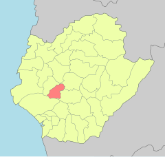
23°5′57.53″N 120°13′37.79″E / 23.0993139°N 120.2271639°E
Anding
安定區 | |
|---|---|
| Anding District | |
 Sesame fields in Anding | |
 | |
| Coordinates: 23°5′57.53″N 120°13′37.79″E / 23.0993139°N 120.2271639°E | |
| Country | |
| Special municipality | Tainan |
| Area | |
• Total | 12.0734 sq mi (31.27 km2) |
| Elevation | 16 ft (5 m) |
| Population (January 2023) | |
• Total | 29,914 |
| • Density | 2,483/sq mi (959/km2) |
| Time zone | UTC+8 (+8) |
| Website | web |

Anding District (Chinese: 安定區; pinyin: Āndìng Qū; Wade–Giles: An1-ting4 Ch'ü1; Pe̍h-ōe-jī: An-tēng khu) is a rural district of about 29,914 residents in Tainan, Taiwan, with an area of 31.27 square kilometers, or 12.0734 square miles. It is the 17th most populous district in Tainan, with a population density of 959 people per square kilometer, or 2,483 people per square mile.
