Andros
Περιφερειακή ενότητα / Δήμος Άνδρου | |
|---|---|
 Andros town | |
| Coordinates: 37°50′N 24°54′E / 37.833°N 24.900°E | |
| Country | Greece |
| Administrative region | South Aegean |
| Seat | Andros (town) |
| Area | |
• Municipality | 380 km2 (150 sq mi) |
| Population (2021)[1] | |
• Municipality | 8,826 |
| • Density | 23/km2 (60/sq mi) |
| Time zone | UTC+2 (EET) |
| • Summer (DST) | UTC+3 (EEST) |
| Postal code | 845 xx |
| Area code(s) | 22820 |
| Vehicle registration | EM |
| Website | www |
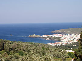
Andros (Greek: Άνδρος, pronounced [ˈanðros]) is the northernmost island of the Greek Cyclades archipelago, about 10 km (6 mi) southeast of Euboea, and about 3 km (2 mi) north of Tinos. It is nearly 40 km (25 mi) long, and its greatest breadth is 16 km (10 mi). It is for the most part mountainous, with many fruitful and well-watered valleys.[2] The municipality, which includes the island Andros and several small, uninhabited islands, has an area of 380 km2 (146.719 sq mi).[3] The largest towns are Andros (town), Gavrio, Batsi, and Ormos Korthiou.
Palaeopolis, the ancient capital, was built into a steep hillside, and the breakwater of its harbor can still be seen underwater.[4] At the village of Apoikia, there is the notable spring of Sariza, where the water flows from a sculpted stone lion's head. Andros also offers hiking options with many new paths being added each year.
- ^ "Αποτελέσματα Απογραφής Πληθυσμού - Κατοικιών 2021, Μόνιμος Πληθυσμός κατά οικισμό" [Results of the 2021 Population - Housing Census, Permanent population by settlement] (in Greek). Hellenic Statistical Authority. 29 March 2024.
- ^ Chisholm 1911.
- ^ "Population & housing census 2001 (incl. area and average elevation)" (PDF) (in Greek). National Statistical Service of Greece. Archived from the original (PDF) on 2015-09-21.
- ^ For an account of Palaeopolis in early 1884, see Theodore Bent, The Cyclades, or Life Among the Insular Greeks. London, 1885, pp. 287-290.

