Anjouan
| |
|---|---|
Autonomous island | |
| Autonomous Island of Anjouan[3] | |
 Anjouan is the easternmost island of the Comoros islands | |
 Anjouan in the Comoros | |
| Coordinates: 12°12′54″S 44°25′30″E / 12.21500°S 44.42500°E | |
| Country | Comoros |
| Capital | Mutsamudu |
| Government | |
| • Type | Autonomous Island within a federal presidential republic |
| • Governor | Zaidou Youssouf |
| Area | |
| • Total | 424 km2 (164 sq mi) |
| Elevation | 1,595 m (5,233 ft) |
| Population (2018) | |
| • Total | 360,409 |
| • Density | 850/km2 (2,200/sq mi) |
| Time zone | UTC+03:00 (EAT) |
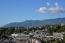
Anjouan ([ɑ̃.ʒu.ɑ̃]) is an autonomous volcanic island in the Comoro Islands in the southwestern Indian Ocean, part of the Union of the Comoros. It is known in Shikomori as Ndzuani, Ndzuwani or Nzwani, and, until the early twentieth century when the name fell out of general use (although still sometimes used by English-speakers in Zanzibar), in English as Johanna.[4] Historically it was also called Hinzuan or Hanzoan.

Its chief town is Mutsamudu and, as of 2006[update], its population is around 277,500. The total area of the island is 424 square kilometers (163 square miles).
- ^ (in French) Site Officiel du Gouvernorat de l'Île Autonome d'Anjouan (Official Site of the Governorate of the Autonomous Island of Anjouan).
- ^ Anjouan.net — Official
- ^ Translation of the French name. (in French) Site officiel du Gouvernorat de l'île autonome d'Anjouan (Official site of the Governorate of the Autonomous Island of Anjouan)
- ^ Stevens, Kenneth (Winter 1986). "Of Whaling Ships and Kings: The Johanna Bombardment of 1851". Prologue. 18: 241–249.
