| Antalo Limestone | |
|---|---|
| Stratigraphic range: Oxfordian-Kimmeridgian ~ | |
 Formation at Kurkura village (Dogua Tembien), holding St. Mika'el's cave | |
| Type | Geological formation |
| Underlies | Mugher Mudstone |
| Overlies | Adigrat Sandstone |
| Thickness | 800 m (2,600 ft) |
| Lithology | |
| Primary | Limestone, marl, calcareous sandstone |
| Other | Grainstone, wackestone |
| Location | |
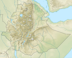
| Coordinates | 13°35′52″N 39°16′38″E / 13.5977°N 39.2772°E |
| Approximate paleocoordinates | 7°30′S 26°36′E / 7.5°S 26.6°E |
| Region | Tigray |
| Country | |
| Extent | Mekelle Outlier, Danakil Alps |
| Type section | |
| Named for | Antalo town |
| Named by | William Thomas Blanford |
| Year defined | 1868 |
The Antalo Limestone, also known as the Antalo Sequence, is a geological formation in Ethiopia. It is between 300 and 800 metres thick and comprises fossiliferous limestones and marls that were deposited in a reef. Marine microfossils have shown an age between 165 and 150 million years.[1][2]
- ^ Sembroni, A.; Molin, P.; Dramis, F. (2019). Regional geology of the Dogu'a Tembien massif. In: Geo-trekking in Ethiopia's Tropical Mountains - The Dogu'a Tembien District. SpringerNature. ISBN 978-3-030-04954-6.
- ^ Bosellini, A.; Russo, A.; Fantozzi, P.L.; Assefa, G.; Tadesse, S. (1997). "The Mesozoic succession of the Mekelle Outlier (Tigrai Province, Ethiopia)". Mem. Sci. Geol. 49: 95–116.
