| Antietam Creek | |
|---|---|
 Burnside's Bridge traversing Antietam Creek near Sharpsburg, Maryland, site of heavy combat during the Battle of Antietam (Sharpsburg) on September 17, 1862 | |
| Location | |
| Country | United States |
| States | Maryland, Pennsylvania |
| Physical characteristics | |
| Mouth | |
• coordinates | 39°25′02″N 77°44′47″W / 39.41722°N 77.74639°W |
| Length | 41.7 mi (67.1 km) |
| Basin size | 290 km2 (110 sq mi) |
| Basin features | |
| River system | Potomac River |
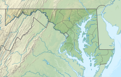
Antietam Creek (/ænˈtiːtəm/) is a 41.7-mile-long (67.1 km)[1] tributary of the Potomac River located in south central Pennsylvania and western Maryland in the United States, a region known as the Hagerstown Valley. The creek became famous as a focal point of the Battle of Antietam during the American Civil War.
- ^ U.S. Geological Survey. National Hydrography Dataset high-resolution flowline data. The National Map Archived 2012-03-29 at the Wayback Machine, accessed August 15, 2011
