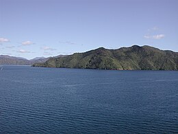
 Southern end of Arapaoa Island | |
 Arapaoa Island relative to the South Island | |
| Geography | |
|---|---|
| Location | Marlborough Sounds |
| Coordinates | 41°11′22″S 174°18′10″E / 41.18951°S 174.30290°E |
| Area | 75 km2 (29 sq mi) |
| Length | 28 km (17.4 mi) |
| Width | 4 km (2.5 mi) |
| Highest elevation | 559.4 m (1835.3 ft) |
| Highest point | Narawhia |
| Administration | |
New Zealand | |
| Region | Marlborough District |
| Demographics | |
| Population | 50 |
Arapaoa Island (formerly spelled Arapawa Island) is the second-largest island in the Marlborough Sounds, at the north-east tip of the South Island of New Zealand. The island has a land area of 75 km2 (29 square miles). Queen Charlotte Sound defines its western side, while to the south lies Tory Channel, which is on the sea route between Wellington in the North Island to Picton. Cook Strait's narrowest point is between Arapaoa Island's Perano Head and Cape Terawhiti in the North Island.