This article's lead section may be too long. (February 2024) |
Aridaia
Αριδαία | |
|---|---|
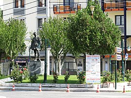
 View of the central square of Aridaia with Aggelis Gatsos' statue. | |
| Coordinates: 40°58′N 22°03′E / 40.967°N 22.050°E | |
| Country | Greece |
| Geographic region | Macedonia |
| Administrative region | Central Macedonia |
| Regional unit | Pella |
| Municipality | Almopia |
| Districts | 17 |
| Area | |
| • Municipal unit | 562.91 km2 (217.34 sq mi) |
| Elevation | 127 m (417 ft) |
| Population (2021)[1] | |
| • Municipal unit | 18,864 |
| • Municipal unit density | 34/km2 (87/sq mi) |
| • Community | 7,118 |
| Time zone | UTC+2 (EET) |
| • Summer (DST) | UTC+3 (EEST) |
| Postal code | 584 00 |
| Area code(s) | 23840-2 |
| Vehicle registration | ΕΕ |
| Website | dimosalmopias.gov.gr |


Aridaía (Greek: Αριδαία, Macedonian: С'ботско, Bulgarian: Съботско)) is a town and a former municipality in the Pella regional unit, Greece. Since the 2011 local government reform, it is part of the Almopia municipality, of which it is a municipal unit.[2] It was the capital of the former Almopia eparchy. It is located in the northwest corner of the Pella regional unit, bordering the southern part of the North Macedonia and the northeast corner of the Florina regional unit. Its land area is 562.910 km2 (217.341 sq mi).[3] The population of Aridaia proper is 7,118, while that of the entire municipal unit is 18,864 (2021 census).[1] The municipal unit is divided into 17 communities. Its largest other communities are Prómachoi (pop. 1,654), Loutráki (1,176) and Sosándra (1,008).
The community of Aridaia includes the settlement of Ydraia with a population of 500 inhabitants.
A Greek battalion entered Aridea on November 4, 1912, during the 1st Balkan War, and it started to develop as a town after the installment of Greek refugees from Asia Minor.[4]
- ^ a b "Αποτελέσματα Απογραφής Πληθυσμού - Κατοικιών 2021, Μόνιμος Πληθυσμός κατά οικισμό" [Results of the 2021 Population - Housing Census, Permanent population by settlement] (in Greek). Hellenic Statistical Authority. 29 March 2024.
- ^ "ΦΕΚ B 1292/2010, Kallikratis reform municipalities" (in Greek). Government Gazette.
- ^ "Population & housing census 2001 (incl. area and average elevation)" (PDF) (in Greek). National Statistical Service of Greece. Archived from the original (PDF) on 2015-09-21.
- ^ "Αριδαία- Αλμωπία : Ιστορική Αναδρομή 1385- 1912 από τον Γιώργο Λιούγκα". Retrieved 2020-08-20.

