Arivaca, Arizona | |
|---|---|
 Arivaca, facing west down Main Street, 2015 | |
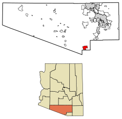
 Location of Arivaca in Pima County, Arizona. | |
| Coordinates: 31°34′38″N 111°19′53″W / 31.57722°N 111.33139°W | |
| Country | United States |
| State | Arizona |
| County | Pima |
| Area | |
| • Total | 27.78 sq mi (71.94 km2) |
| • Land | 27.78 sq mi (71.94 km2) |
| • Water | 0.00 sq mi (0.00 km2) |
| Elevation | 3,643 ft (1,110 m) |
| Population (2020) | |
| • Total | 623 |
| • Density | 22.43/sq mi (8.66/km2) |
| Time zone | MST (no DST) |
| FIPS code | 04-03320 |
Arivaca (O'odham: Ali Wa:pk) is an unincorporated community in Pima County, Arizona, United States.[2] It is located 11 miles (18 km) north of the Mexican border and 35 miles (56 km) northwest of the port of entry at Nogales. The European-American history of the area dates back at least to 1695, although the community was not founded until 1878.[2] Arivaca has the ZIP code 85601.[3] The 85601 ZIP Code Tabulation Area had a population of 909 at the 2000 census.[4]
- ^ "2020 U.S. Gazetteer Files". United States Census Bureau. Retrieved October 29, 2021.
- ^ a b Arivaca Archived September 17, 2007, at the Wayback Machine, Arizona Department of Commerce, August 10, 2007. Accessed 2007-09-07.
- ^ "Zip Code Lookup". Archived from the original on June 15, 2011.
- ^ "U.S. Census website". United States Census Bureau. Retrieved January 31, 2008.

