 | ||||
| Route information | ||||
| Maintained by ArDOT | ||||
| Section 1 | ||||
| Length | 25.12 mi[1] (40.43 km) | |||
| South end | ||||
| Major intersections |
| |||
| North end | ||||
| Section 2 | ||||
| Length | 16.17 mi[2] (26.02 km) | |||
| South end | Pulaski–Faulkner county line east of Mayflower | |||
| Major intersections | ||||
| North end | End of state maintenance west of Mayflower | |||
| Location | ||||
| Country | United States | |||
| State | Arkansas | |||
| Counties | Lonoke, Pulaski, Faulkner | |||
| Highway system | ||||
| ||||


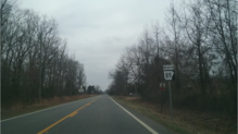
Highway 89 (AR 89, Ark. 89, and Hwy. 89) is a highway in the central part of the U.S. state of Arkansas.
- ^
- Arkansas Department of Transportation (2019). State Highway Route and Section Map - Lonoke County (PDF) (Map). Retrieved February 15, 2021.
- Arkansas Department of Transportation (2019). State Highway Route and Section Map - Pulaski County (PDF) (Map). Inset in upper-right corner. Retrieved February 15, 2021.
- ^
- Arkansas Department of Transportation (2019). State Highway Route and Section Map - Faulkner County (PDF) (Map). Retrieved February 15, 2021.
- AR 365 concurrency: Arkansas State Highway and Transportation Department; U.S. Department of Transportation Federal Highway Administration (2011). General Highway Map - Faulkner County, Arkansas (PDF) (Map). [1:62500]. Retrieved February 15, 2021.
