| Armidale New South Wales | |||||||||
|---|---|---|---|---|---|---|---|---|---|
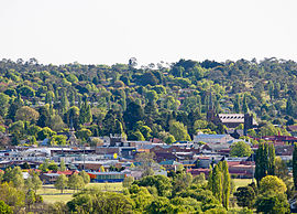
 Looking across Armidale city, December 2013 | |||||||||
| Coordinates | 30°30′S 151°39′E / 30.500°S 151.650°E | ||||||||
| Population | 21,312 (UCL 2021)[1] | ||||||||
| Established | 1849 | ||||||||
| Postcode(s) | 2350, 2351 | ||||||||
| Elevation | 980 m (3,215 ft) | ||||||||
| Location |
| ||||||||
| LGA(s) | Armidale Regional Council | ||||||||
| County | Sandon | ||||||||
| State electorate(s) | Northern Tablelands | ||||||||
| Federal division(s) | New England | ||||||||
| |||||||||
Armidale is a city in the Northern Tablelands, New South Wales, Australia.[2] Armidale had a population of 23,967 as of the 2021 census.[3] It is the administrative centre for the Northern Tablelands region. It is approximately halfway between Sydney and Brisbane at the junction of the New England Highway and Waterfall Way.
Armidale is a rural university town,[4] home to the University of New England (UNE).
- ^ Australian Bureau of Statistics (28 June 2022). "Armidale (urban centre and locality)". Australian Census 2021.
- ^ Armidale Archived 16 July 2016 at the Wayback Machine Retrieved 23 October 2010
- ^ "2021 Armidale, Census All persons Quickstats". Australian Bureau of Statistics. Australian Bureau of Statistics. 2021. Retrieved 8 January 2024. Estimated resident population, 30 June 2018.
- ^ "Armidale". The University of Newcastle, Australia. 4 June 2013.
