This article needs additional citations for verification. (May 2024) |
Aroor | |
|---|---|
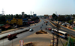
 Aroor bypass | |
| Coordinates: 9°53′N 76°18′E / 9.88°N 76.3°E | |
| Country | |
| State | Kerala |
| District | Alappuzha |
| Area | |
| • Total | 15.15 km2 (5.85 sq mi) |
| Population (2011) | |
| • Total | 39,214 |
| • Density | 2,600/km2 (6,700/sq mi) |
| Time zone | UTC+5:30 (IST) |
| PIN | 688534 |
| Telephone code | 0478 |
| Vehicle registration | KL-32 |
| Lok Sabha constituency | Alappuzha |
| Niyamasabha constituency | Aroor |

Aroor is a fishing village on the northernmost part of the Alappuzha district, within Cherthala taluk of Kerala, India. It lies on either sides of National Highway 66 and serves as a gateway between Kochi and Alappuzha. Aroor, surrounded by Vembanad, Kaithappuzha, and Kumbalangi backwaters, is known for its seafood export industry.[1] The Aroor-Kumbalam Bridge is the second-longest bridge in Kerala.
- ^ "Revenue Portal". village.kerala.gov.in. Retrieved 9 April 2024.

