Arthur N. Neu Airport | |||||||||||||||
|---|---|---|---|---|---|---|---|---|---|---|---|---|---|---|---|
| Summary | |||||||||||||||
| Airport type | Public | ||||||||||||||
| Owner | City of Carroll | ||||||||||||||
| Serves | Carroll, Iowa | ||||||||||||||
| Elevation AMSL | 1,204 ft / 367 m | ||||||||||||||
| Coordinates | 42°02′46″N 094°47′20″W / 42.04611°N 94.78889°W | ||||||||||||||
| Website | cityofcarroll.com/... | ||||||||||||||
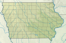
| Map | |||||||||||||||
 | |||||||||||||||
| Runways | |||||||||||||||
| |||||||||||||||
| Statistics | |||||||||||||||
| |||||||||||||||
Arthur N. Neu Airport (IATA: CIN, ICAO: KCIN, FAA LID: CIN) is a public airport five miles southeast of Carroll, in Carroll County, Iowa.[1] Also known as Arthur N. Neu Municipal Airport, it was established at its current location in the 1940s.[2]
- ^ a b FAA Airport Form 5010 for CIN PDF, effective Jan 5, 2017.
- ^ Arthur N. Neu Municipal Airport Archived May 24, 2009, at the Wayback Machine page at City of Carroll website

