| Arwadito | |
|---|---|
 The Arwadito River at Agerbi'a | |
Arwadito River in Dogu’a Tembien | |
| Location | |
| Country | Ethiopia |
| Region | Tigray Region |
| District (woreda) | Dogu’a Tembien |
| Physical characteristics | |
| Source | Ts’ats’en Plateau |
| • location | Agerbi’a in Lim'at municipality |
| • elevation | 2,700 m (8,900 ft) |
| Mouth | Zelekwa or upper Tanqwa River |
• location | Agerbi’a in Lim'at municipality |
• coordinates | 13°37′52″N 39°08′46″E / 13.631°N 39.146°E |
• elevation | 2,403 m (7,884 ft) |
| Length | 2 km (1.2 mi) |
| Width | |
| • average | 8 m (26 ft) |
| Basin features | |
| River system | Seasonal river |
| Landmarks | Basalt cliffs with eucalypts |
| Bridges | On main road Mek'ele-Abiy Addi |
| Topography | Mountains and gorges |
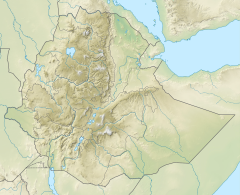
The Arwadito is a torrent of the Nile basin. Rising on the Ts’ats’en plateau of Dogu’a Tembien in northern Ethiopia, it flows northward to empty finally in the Giba and Tekezé River.[1]
- ^ Jacob, M. and colleagues (2019). Geo-trekking map of Dogu'a Tembien (1:50,000). In: Geo-trekking in Ethiopia's Tropical Mountains - The Dogu'a Tembien District. SpringerNature. ISBN 978-3-030-04954-6.
