Ashgabat
Aşgabat | |
|---|---|
| Nickname: White Marble City [1] | |
Location in Turkmenistan | |
| Coordinates: 37°56′15″N 58°22′48″E / 37.93750°N 58.38000°E | |
| Country | |
| Founded | 1881 |
| Districts | 4 districts[2] |
| Government | |
| • Type | Presidential[3] |
| • Mayor | Rahym Nurgeldiyewic Gandymow (since 9 June 2021) [4] |
| Area | |
| • Total | 470 km2 (180 sq mi) |
| Elevation | 273 m (896 ft) |
| Population (2022 census)[5] | |
| • Total | 1,030,063 |
| • Density | 2,200/km2 (5,700/sq mi) |
| Time zone | UTC+05:00 (Turkmenistan Time) |
| • Summer (DST) | (Not Observed) |
| Postal code | 744000–744040 |
| Area code | (+993) 12 |
| Vehicle registration | AG |
| International Airports | Ashgabat International Airport |
| Rapid transit system | Ashgabat Monorail |
| Website | ashgabat.gov.tm |

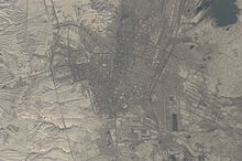
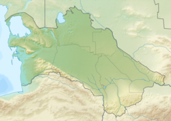
Ashgabat (Turkmen: Aşgabat)[a][b] is the capital and largest city of Turkmenistan.[8] It lies between the Karakum Desert and the Kopetdag mountain range in Central Asia, approximately 50 km (30 mi) away from the Iran-Turkmenistan border. The city has a population of 1,030,063 (2022 census).
The city was founded in 1881 on the basis of an Ahal Teke tribal village, and made the capital of the Turkmen Soviet Socialist Republic in 1924 when it was known as Poltoratsk.[c] Much of the city was destroyed by the 1948 Ashgabat earthquake, but has since been extensively rebuilt under the rule of Saparmurat Niyazov's "White City" urban renewal project,[9] resulting in monumental projects sheathed in costly white marble.[10] The Soviet-era Karakum Canal runs through the city, carrying waters from the Amu Darya from east to west.[11]
Today, as the capital of an independent Turkmenistan, Ashgabat retains a multiethnic population, with ethnic Turkmen as the majority. In 2021, it celebrated 140 years of its written history.[12]
- ^ "Ashgabat celebrates the City Day". turkmenistan.gov.tm. May 23, 2024.
- ^ "General information". www.mfa.gov.tm.
- ^ "Türkmenistanyň Halk Maslahatynyň Çözgüdi HM-6 14 December 1992" (PDF).
- ^ "Türkmenistanyň Prezidentiniň gol çeken resminamalary". TDH. Turkmenistan State News Agency (TDH) - Turkmenistan Today. July 9, 2021. Archived from the original on August 5, 2022. Retrieved July 9, 2021.
- ^ "Turkmenistan: Regions, Major Cities & Towns - Population Statistics, Maps, Charts, Weather and Web Information". www.citypopulation.de.
- ^ "Ashgabat". CollinsDictionary.com. HarperCollins. Retrieved December 1, 2023.
- ^ "Ashgabat | Definition of Ashgabat in English by Oxford Dictionaries". Oxford Dictionaries | English. Archived from the original on November 23, 2018. Retrieved November 23, 2018.
- ^ "ЗАКОН ТУРКМЕНИСТАНА О статусе столицы Туркменистана". turkmenistan.gov.tm. April 12, 2016.
- ^ Pannier, Bruce (July 21, 2004). "Turkmenistan: Government Orders People Out Of Their Homes In Name Of 'Urban Renewal'". Radio Free Europe/Radio Liberty. Retrieved November 22, 2017.
- ^ Scott, Noel (October 28, 2010). Tourism in the Muslim World. Emerald Group Publishing. ISBN 978-1-84950-920-6.
- ^ "Brief Note on Turkmenistan". Embassy of India, Ashgabat. Archived from the original on February 18, 2014. Retrieved June 10, 2014.
- ^ "Ашхабад-140 лет: воплощение достижений независимости". turkmenistan.gov.tm. April 19, 2021.
Cite error: There are <ref group=lower-alpha> tags or {{efn}} templates on this page, but the references will not show without a {{reflist|group=lower-alpha}} template or {{notelist}} template (see the help page).


