| Asse | |
|---|---|
 | |
| Highest point | |
| Peak | Remlinger Herse |
| Elevation | 234 m above NHN |
| Geography | |
| State(s) | Wolfenbüttel county, Lower Saxony (Germany) |
| Range coordinates | 52°08′25″N 10°39′00″E / 52.14028°N 10.65000°E |


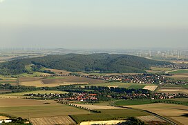
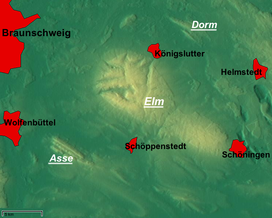
The Asse is a small hill range in the district of Wolfenbüttel in southeastern Lower Saxony with a median height of 200 metres ASL; the highest elevation is the Remlinger Herse with a height of 234 m. There are more than 600 different plants found here; the Asse is mostly covered by trees. It has been inhabited since the 6th millennium BC by farmers coming from the Danube region.
For several hundred years, salt has been mined in Asse. One of these mines, Schacht Asse II, is now used to store low- and medium-grade radioactive waste produced by medicine and nuclear power plants.
